Miravalles Volcano

Miravalles Volcano

Miravalles Volcano

Miravalles Volcano

Costa Rica Miravalles Volcano

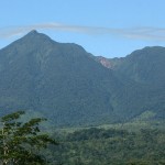
Miravalles Volcano is dramatic in the 21-mile range of the mountains of Guanacaste Liberia outside east-southeast, the province of Guanacaste has a warm and dry, as well as beautiful white sand beaches.

The Miravalles Volcano is inspiring 1969ft or about 600m above sea level, has a total height of 2028m and the total area of 28.840 hectares. 10,850 hectares of land surrounding the volcano have been recognized as a protected area, these protected areas and Forest Reserve are called Miravalles since March 16, 1976.

This reserve protects rivers and streams that come through the Gulf of Nicoya in the fields of Nicaragua.

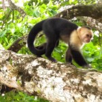
The complex also houses a stratovolcano Miravalles beautiful cloud forest and primary forest that overflows with coconut palms, epiphytes and ferns, while also being home to wild cats, coyotes, white-tailed deer, small mammals, white-faced capuchin and peccary just to name a few of the wildlife species that run rampant here.

 The Guanacaste Volcano

Miravalles Volcano has young lava flows that poured into the western and southwestern slopes.

At the peak of Miravalles you discover six eruption points, although the main crater is dormant.

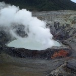
This splendid volcano is adorned with hot mud pools (some mudpots are measured to be as deep as 5 -. 6.5 feet with diameters as large as 16 to 20 feet), bubbling water pools, waterfalls, hot springs, fumaroles and crystallized sulfur.

The geographical position of the flow of Miravalles Volcano interrupts cloud coming from the Caribbean coast, which produces frequent rain, heavy cloud covers, extremely strong winds (sometimes even more than 62miles/hr) and cold rains. Annual precipitation can reach up to 140 inches.

Normal temperatures in the area range from 75F to Miravalles 90F.

At the top of the volcano temperatures usually recorded between 42F and 48F, but have been known to fall to a minimum of 32F.

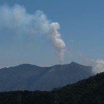
Although Miravalles volcano is constantly monitored, the last known “eruption” was a small geyser of steam explosion that took place in 1946.

Some small seismic activity occurs regularly inside and under the main crater.

Miravalles Volcano Costa Rica

Miravalles Volcano Costa Rica

 Miravalles Volcano Guanacaste Costa Rica

Miravalles Volcano is known for its various attractions, the most famous is probably the center of The Burners route located in the southwest, a family business that has created a spa living museum showing hydrothermal movement along with other great features of the volcano.

Costa Rica’s oldest pre-Hispanic archaeological finds were discovered in the Miravalles Volcano.

Since 1977, the Instituto Costarricense de Electricidad has been the office of Seismology and Volcanology in the Geological Engineering Department to observe the activity that takes place in the Miravalles Volcano.

An ambitious development called Miravalles Geothermal Project is a huge underground reservoir that is heated by geothermal activity that aims to harness this reservoir is a power plant that generates electricity actually for the area.

Tourists come here to hike, pamper yourself, horseback riding and admire the incredible natural beauty.

Miravalles has 2 different paths lead through rough terrain to the summit; do not forget to also bathe in volcanic clays produced here, known for its therapeutic properties. Visit Miravalles and experience nature in a different level.

 

Turrialba Volcano

Turrialba Volcano

Turrialba Costa Rica

Turrialba Costa Rica

 Costa Rica Turrialba Volcano

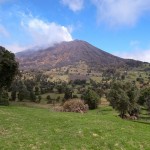
With an altitude of 3,340 m Turrialba Volcano is an andesitic stratovolcano-basalt.

ASL in the village of that name is located about 16 km to the northwest.

The huge caldera opens to the northeast, and NE-SW and NW-SE 500 and 800 meters to 2200 meters size. They are the main craters, Diameter flashing surface, about 100 meters to the east.

Flashing the center of a Crater Lake wall fumarolic activity in the region observed is due to rainfall. N-edge medicines that you carved for exploitation of the accumulation of sulfur in the area adjacent to it, you can also see some terraces.

Finally, W of the crater, which combines the most recent dating back almost 150 years with magmatic activities. Of gases and vapors from the bottom of the crater outflows worth the steep walls of the screen and the background is filled with data.

Turralba Volcano Activity

Turrialba Costa Rica Volcano

Turrialba Costa Rica Volcano

Last eruption of Turrialba left behind it mark.

With lavas Event, pyroclastic rocks and ash carryout by a strong wind hundreds of miles away to the west, the duration of the explosive impact with strong winds current to Central Valley, which was from 1864 to 1886 and in the February 1866 report, the most important period of activity in the explosion.

There are reports of fumaroles activity in 1899, 1920, 1957, 1969, 1971, from 1980 until today. Then, the center and west of the crater fumarolic volcanic activity at a much lower temperature is maintained.

Currently, the steam and volcanic gas are constant and the small outer wall of the activities of a particular body part and are unstable.

Lying in Central Valley creating a potentially explosive, geographic location, altitude and climatic conditions of the most densely populated in country, represents a major threat to development at the Turrialba volcano.

Volcano Turrialba Remains high on visitors compared with other tourists volcanoes in the country, even with a variety of difficulties that happened in region including access to Turrialba volcano itselft. However, due to the upper portion of the main access road and improve the quality remains accessible to most of the containers, this situation is changing rapidly.

The percentage of visits soon become a reality, and community organizations to organize properly in the field involved in the most accurate result, important changes, along with the balance of nature according to the local economy and social structure, the principles of community development to promote integrated planning for land use.

Turrialba volcano is a mirror of country beauty and its wonderful places to visit.


Jaco Beach Tours

Tenorio Volcano National Park

Tenorio Volcano National Park

Costa Rica Tenorio Volcano

Costa Rica Vacations in Jaco

Tenorio Volcano National Park

Tenorio Volcano National Park

Tenorio Volcano is Part of the Conservation Area of Arenal, This Volcano and National Park is one of the newest parks in Costa Rica.

This National Park was created in 1995 to protect the assets Tenorio Volcano and surrounding forestation.

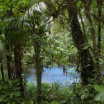
Tenorio national park is home to the very beautifully and famous River Celeste, (sky-blue River). Volcano National Park is rich is extreme natural beauty with the habitat of the four different life zones and a zone of transition.

Tenorio is Located near the famous Arenal Volcano National Park and Lake Arenal, Tenorio Volcano National Park has a really good reputation due it great diversity of flora and fauna.

This region has extremely biodiverse and lush, here there many different plants and tree species that grow beautifully, also the national park is home to many kinds of palms, ferns, heliconias, orchids, trees and bromeliads.

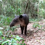
This Park host wide varieties of animals, probably the some of the more popular are; howler monkeys, puma, squirrels, tapir, agoutis, as well as many species of birds.

Because of its location and climate, the Volcano Tenorio plays a very important role,  one of the main functions is to act as a natural boundary to the northeast trade winds.

Pre-transition from moist mountain forests of the large number of dwarf cloud forests in this zone make this area and incredibly beautiful park.

If come around here, you need visit the Blue River on the northeast side of Tenorio Volcano. Famous due its blue color waters, this blue coloring is the result of many minerals mixed in the water.

In spite of, a number of hot springs, fumaroles, mud pots in the park too, Important notices, be careful when passing near them, as you can get burn, So be aware.

Tenorio Volcano National Park Costa Rica


Tenorio Volcano

Tenorio Volcano National Park Tapir

Tenorio Volcano  National Park offered an excellent area for walking as well.

The Park has ranger station, Opening from 8 am to 4 pm. And counts with services like, first aid facilities, drinking water, bathrooms, you should know that Camping is not permitted in the park, unless the trails all the way to the top of the volcano.

Tenorio Volcano has various short trails, leading to a pool and picnic area. You will find a wide varieties of activities to do around here, and you will not be disappointed to come here.


We have Activities and the best tours in Jaco Beach….!! White Water Rafting at Savegre, Surf Classes, Expeditions to Manuel Antonio National Park, Sport Fishing, Water fall Expeditions Tours, Costa Rica Canyoning in Jaco, Carara National Park, Honeymoon  Vacation Packages, Private Transportation, as many other activities..

Rincon de la Vieja

Rincon de la Vieja

Rincon de la Vieja National Park

Rincon de la Vieja Costa Rica

Rincon de La Vieja

Rincon de la Vieja Volcano and National Park is comparatively undiscovered gem still in Costa Rica.

Within it is the active volcano Rincon de la Vieja, an andesitic stratovolcano, one of the 5 volcanoes in the range of Guanacaste. The highest peak of Rincon de la Vieja is of 1916 meters above sea level.
Rincon de la Vieja is the easier to access of all volcanoes in the range, though still remote enough that there has been a natural wilderness, so far little negative impact on tourism.

The Rincon de la Vieja The National Park is also part of World Heritage site, the Guanacaste Conservation Area.
Rincon de la vieja this name meant in English (The old woman’s Hook) so this name is referring to the legend of a young woman whose lover was thrown into this volcano by her father, and the legend says after that what happened is that she became a recluse with healing powers.
The highest peak of Rincon de la Vieja is over 1916 meters; nevertheless, the most active area is the Von Seebach peak containing a crater lake with an acid. This can be climbed.

When to visit

To visit Rincon the best times is during the rainy season (May to November) it is better during this season because the fumaroles and boiling mud pots are more active, on the other side of the crater usually cloud-covered, and so this is not the best time to hike this Volcano up to the top. If decided to do this, make sure you check weather reports and head out early during the morning so you have the best change.

Getting to Rincon de la Vieja

Check out our map of northwestern Costa Rica to see where Rincon de la Vieja National Park is located. It’s takes just about 45 minutes from city of Liberia or Liberia airport, so if you are not driving.

You can take a public buses from liberia to the Guachipelin these buse runs 3 times a day

You can reach the top of Rincon de la Vieja, best time hike up to top is during the dry season from (February to April) that if you are trying to get the points of view, These is a 8 km trail which starts from the Ranger Station Pailas. The first 6 kms up the gentle slope, the final 2 km ascends steeply to the crater, so this is the point when you will be arriving, breathless, to see the mysterious volcanic landscape.
Beware at the top, as high winds and poor visibility are very possible.

There are no guides or guards to stop leaning over and taking into account that you stand on the rock and ash this is not recommended unless you want to dive to 200 meters in the acid lake!
You can start at the bottom warm, however is likely to be a little or a lot more cooler on top, so you should be ready and prepare with rain jacket with long pants.

Fauna at Rincon del Vieja Park

The National Park Rincon de la Vieja was created in 1973 and its remoteness has helped maintain a single healthy population, abundant wildlife.

As you ascend to the flanks of the volcano will go through different elevations, accompanied by changes in the flora and fauna around them.
Poultry
Then National Park is home to a variety of bird and other.

The species found in this area includes, spectacled owl, blue collar Goldentail, emerald toucan, black-faced solitaire, laughing falcon, whitefronted parrot, the oriole of Montezuma, red trogon, and peacock, just mention some.

Mammals in the area

Rincon de la Vieja National Park Mammals

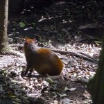
Dasyprocta punctata (Guatuza, cherenga)

Some of the Mammals found here are the coatis, peccaries, skunks and monkey’s howler monkeys, white faced, also 2 fingers sloths, anteaters, and Armadillos.

Rincon de la Vieja National Park has one of larges population of Costa Rica’s national flower, the orchid name (Guaria Morada)
It is recommended to ask for local advice to get the best and safest roads, as steam vents and mud Boling dot the flanks of the volcano.

Ironically this activity is also obvious why it is considered safe volcano. Volcanoes that are verbatim ‘leaving water vapor’ are more likely not going to have a major eruption, as it is not building up pressure.

The skirts have many well-marked trails that take you to the clay pots, fumaroles, waterfalls and swimming holes, mostly of them are around the entrance of Las Pailas in the park. A trail takes you to the summit. Another trail leads to 5 km Waterfall Cangreja, where a waterfall crashes in a bright blue lagoon. The trail leads through forests and grasslands.

Also there is a trail to Hidden Falls 4.3 km, a waterfall just a bit smaller.
This area have multitude of entertainment activities to do. of course, the hiking itself off after picking up a map from a ranger station.

Parrita Costa Rica

Parrita Costa Rica

The Canton of Parrita  Costa Rica


Parrita Costa Rica

Parrita Costa Rica Oil Palms

The geographical coordinates of the canton of  Parrita  Costa Rica mean are given by 09 ° 33’02 “north latitude and 84 ° 20’54” west longitude.

The maximum width of forty-six miles to the northeast to southwest, from the top of the hill to the mouth of St. Jerome Tusubres River in the Pacific Ocean.


Almost the entire territory of Costa Rica was inhabited before the arrival of the Spanish. In 1924.

The First banana plantation was settled here by a young German, establish in this areas surrounding Pirrís river (Parrita), which encourages people to migrate from Guanacaste and San Jose to this region.

Parrita, This name has its own history and goes back, when to time when a woman named Rita, who lived in this area. So she had a business of sending and receiving packets.. So when people send packages they said ( es pa Rita) “Which is mean to Rita” so it is to Rita was heard so often in the small town, that soon everybody referred to This place as Parrita.

Parrita Costa Rica Economy

Parrita Costa Rica Monkeys

Parrita Costa Rica Monkeys

Parrita Costa Rica is surrounded by rivers, they are; Pirris or parrita Palo Seco, Damas, Chires, and Jicote. The Area has had some very serious flooding problems close the mouth of these rivers.
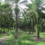
The economy is principally engaged in the production of palm oil.

These large extensions of Oil Palms were cultivated to replace the banana industry.

The weather in Parrita is very hot, and the elevation is only 15 meters above sea level.

Along the coast road past Hermosa Jaco area, cross the river and enter Parrita county. Due to a change in the coastal topography, Pacific beaches in the area of Costa Rica mainly heading to the south.

Esterillos West and Est., and the small beach Bejuco, are quiet residential neighborhoods, with an occasional group of tourists who enjoy the surf.

Tourists can find accommodation in hotels to small wave’s camps and luxury vacation rentals in Costa Rica, with very little in the midrange price.

The community of Parrita can be reached by highway Guapinol Puriscal and inland mountains of Talamanca.

The city itself is traversed by the great river basin Parrita, and further south is the RioPalo Seco and its estuary, these have created a barrier island, Palo Seco.

A dirt road just south of Parrita, Will take you to 8 kilometers to Palo Seco Beach. A gray sand beach protected by mangroves, braided and channels Palo Seco and damas River.

Damas River is Estuary mangrove forest and home to crocodiles, Pumas, monkeys, coati’s wide varieties of birds, and this place is much visited specially people who are trying to see monkeys.

Damas is across the estuary to 400 meters wide and can be reached by boat.


Irazu Volcano

Irazu Volcano

Irazu Volcano

Irazu Volcano

Irazu Volcano National Park

One of the most visited national parks in Costa Rica is the Irazu Volcano National Park is located about 32 kilometres from Cartago, former capital.

Home of the highest active volcano in Costa Rica Irazu, the volcano stands at about 11,260 meters, and this national park has a very convenient located near the city and is within easy driving distance.

To reach the Irazu Volcano National Park, you can take the short drive or bus ride from San Jose, which is about 50 km to the east, and from here you can take the highway to Cartago, enjoying the beauty of the country views along the way.

“Irazu”.” An active stratovolcano, Irazu has had a series of volcanic eruptions in recent years.

The first recorded eruption was in 1723 by Diego de la Haya, after which one of the five craters of Irazu has been appointed.

The Irazu erupted for the last time in 1994. Nevertheless, in 1963 just the same day President John F. Kennedy made an official trip to Costa Rica, the volcano woke up after a period of 20 years, then went to stay active state for two years before went to inactive.


Irazu Volcano Largest


Irazu Volcano Costa Rica

Irazu Volcano Costa Rica

With an area of 500 square kilo meters at its base, the irazu is also the largest volcano in Costa Rica.

Volcanic ash has made the surrounding soil very fertile; however there is not much wildlife to be found here, because of the volcanic activity.
Foxes, Robins, owls, rabbits, hummingbirds, coyote’s porcupines, are some of the commons animals that can be observed in this national park.
The scenery of Irazu Volcano is actually quite surreal.

With most of the national park forests on the Caribbean side volcano.

The volcanoes surrounding vegetation is mostly a forest that has gaps in shrubs and bushes.

High on the summit of Irazu, only a few plants are found that have adapted to the harsh and cold winds that blow here.

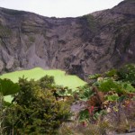
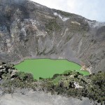
One major attraction of this park is the ascent to the crater of the Hague Diego has 300 meters of green lake in the canter of it.

You  allow driving to the crater or hiking on foot, but do not forget to bring some warm clothes as it can be pretty cold up there.
The best time to of year to visit is between March and April, as there is not much rain, and visitors can see both the Atlantic and Pacific Ocean from the summit of Irazu on a clear day.

Many hiking trails are found in the park, and several services, shop, souvenir, picnic areas, restrooms, and much more..

We Provide Transportation and Private Transfers in Jaco Beach..